
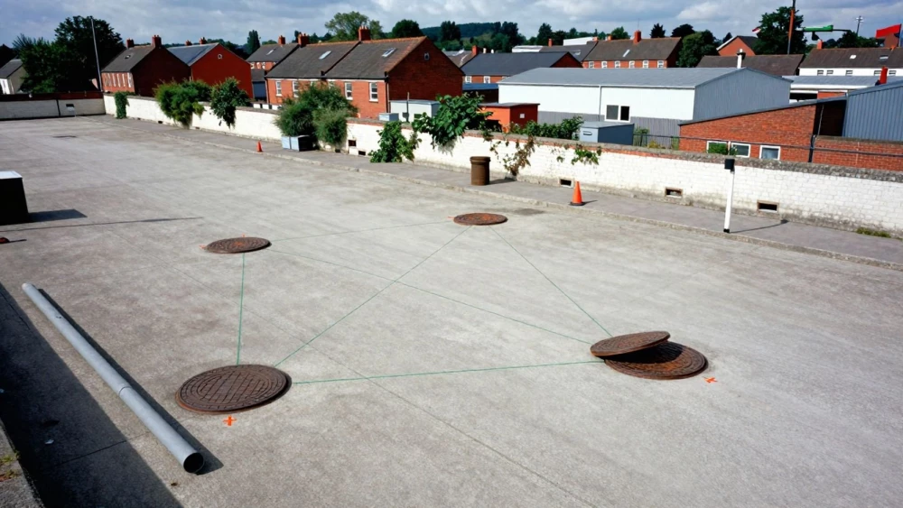
Drainage Mapping Surveys
Get in TouchAt Luton Surveys, we specialise in providing detailed drainage mapping surveys . Our service involves accurately identifying and mapping the underground utility infrastructure, which is crucial for construction projects and property developments.
We use state-of-the-art technology, including Ground Penetrating Radar (GPR) and Electromagnetic Locators (EML), to ensure precise results. Our surveys help you avoid costly disruptions and comply with legal requirements.
Get in touch with us to discuss our services and how we can assist you.
Book Drainage Mapping Surveys Today
How Much Does Drainage Mapping Survey Cost?
A drainage mapping survey typically costs between £300 and £600, depending on the size and complexity of the site. Factors affecting the cost include the scope of the survey, the specific technology required, and the type of drainage infrastructure present.
For example, surveying a commercial property with intricate drainage systems might involve using ground-penetrating radar or sonar detection equipment, which can affect pricing. Additionally, the need for CCTV drain inspection to identify blockages or damages is another cost consideration.
At Luton Surveys, we use advanced software to ensure precise mapping, meeting industry standards such as PAS 128:2022, which governs underground utility detection. We offer competitive pricing structured per project, ensuring you get accurate insights at fair rates.
Contact us today for a tailored quote.
Who Needs Drainage Mapping Surveys?
Drainage mapping surveys are essential for property developers, construction managers, and engineers. These surveys use advanced techniques such as ground-penetrating radar (GPR) and electromagnetic detection to provide detailed maps of underground utilities.
They are critical when planning new developments, renovations, or infrastructure projects where underground utilities are involved. Identifying existing drainage systems, pipelines, and sewers helps avoid costly delays and damage during construction.
Accurate mapping can prevent potential disruptions and ensure that projects comply with safety regulations, such as the Building Regulations and British Standards. Environmental consultants also rely on these surveys to assess flood risks and manage water drainage effectively.
With projects ranging from residential builds to large-scale commercial developments, drainage mapping is a key component of successful planning and execution. Contact us to schedule your drainage survey and ensure your project proceeds smoothly.
How Does a Drainage Mapping Survey Work?
A drainage mapping survey typically involves the following steps, executed with precision and adherence to industry standards to ensure accurate results:
Site Assessment: We evaluate the project site to understand the surveying requirements. This includes assessing any potential access limits or obstructions that may affect the survey.
Utility Detection: Using equipment such as Ground Penetrating Radar (GPR) and Electromagnetic Locators (EML), we detect underground utilities, including pipes, cables, and drainage systems. Our technology can identify utilities made of different materials like PVC, clay, and metal.
Data Analysis: We analyse the collected data to create an accurate map of the subsurface utilities. This step involves aligning detected signals with geographical coordinates to ensure precision.
Report Generation: A detailed report is provided, showcasing utility locations and recommendations. Our reports comply with PAS 128 standards, ensuring reliability and consistency in our findings.
By following these structured steps, we help property developers, engineers, and facility managers make informed decisions. Contact us to schedule a survey.
What Are the Benefits of Drainage Mapping Surveys?
Drainage mapping surveys offer several advantages for both residential and commercial properties. These surveys accurately capture the locations of underground utilities and infrastructure, using technologies like ground-penetrating radar and electromagnetic detection to gather precise data.
Accurate data on pipe materials, diameters and gradients is crucial for effective maintenance and repair.
Accurate Data: Provides precise utility and infrastructure locations, capturing important details about pipe dimensions and materials.
Cost Efficiency: Minimises project delays and unexpected expenses by identifying potential obstructions before excavation commences.
Compliance: Ensures compliance with safety and legal requirements, adhering to standards such as PAS 128, which outline best practices for underground utility detection.
Project Planning: Facilitates informed decision-making for construction projects by providing a clear layout of existing systems and potential areas for expansion.
Conducting these surveys can significantly reduce risks, ensuring smooth project execution. Contact us today to learn more about these benefits.
Why Choose Luton Surveys for Drainage Mapping Surveys?
Luton Surveys is a trusted name for drainage mapping surveys due to our experienced team and specialised technology. We employ methods such as CCTV drain surveys and Ground Penetrating Radar (GPR) to reveal the precise layout of drainage systems, detecting any blockages or defects with accuracy.
Our equipment can map complex networks, including those with buried or inaccessible pipes, and we adhere to industry standards such as the PAS 128 specification to assure quality and consistency.
Our team is skilled in interpreting data and creating detailed reports for both residential and commercial properties, catering to developers, architects, and property managers. These comprehensive reports are an asset during construction planning, renovations, or when investigating drainage disturbances.
Our commitment to professionalism and customer satisfaction sets us apart. Reach out to us for reliable drainage mapping solutions.
Speak to a Drainage Mapping Surveys Expert
Frequently Asked Questions
How long does a drainage mapping survey take?
Most drainage mapping surveys take between one to three days, depending on the site's size and complexity. We complete surveys efficiently without compromising accuracy.
How can I book a drainage mapping survey with Luton Surveys?
Booking a survey with us is straightforward. Contact us directly through our website or call our team to arrange your survey at a suitable time.
What technologies are used in drainage mapping surveys?
We use technologies such as Ground Penetrating Radar (GPR) and Electromagnetic Locators (EML) to ensure precise utility mapping.
Are drainage mapping surveys required for all construction projects?
While not legally mandatory for every project, these surveys are highly recommended to avoid the risk of damaging underground utilities, which can lead to significant project delays and costs.
Is there a minimum job size for the drainage mapping surveys?
We cater to both small and large projects and offer services to suit any project's needs. Contact us to discuss the specifics of your project.
Get a Free Quote for Drainage Mapping Surveys
Get in touch with Luton Surveys today to arrange a drainage mapping survey for your project. We are ready to provide a detailed and cost-effective solution tailored to your needs.